Great Smoky Mountains Travel Guide: Entrances & Scenic Drives

Updated: 3 hours ago

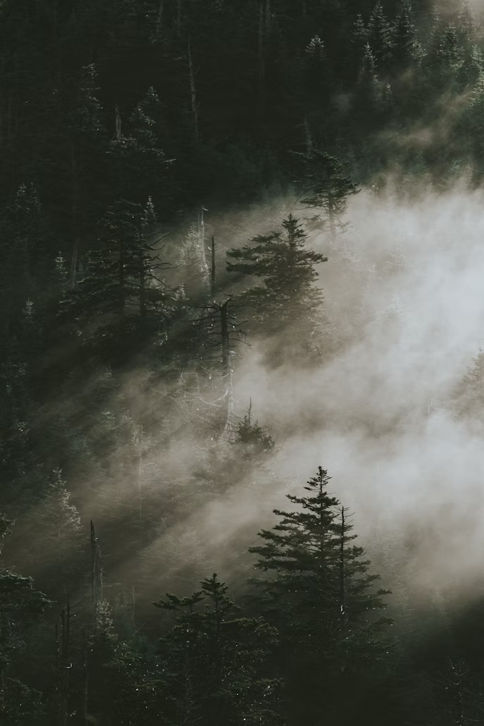
As you drive through the hazy blue ridges, the allure of the Smokies becomes apparent. The mist that curls off the endless layers of forested peaks conceals a world of waterfalls, wildlife, and traces of Appalachian culture. With over 12 million visitors each year, the Great Smoky Mountains National Park is America's most visited national park. And it's no wonder. It's a unique blend of untamed beauty and history, where old-growth forests and blooming wildflowers coexist with pioneer cabins and historic churches. The park is a UNESCO World Heritage Site and a Biosphere Reserve, recognized for its rich plant and animal life and the long work to protect it.
The Smokies are a living haze of history and wilderness, where blue ridges fold into forever and every turn reveals a story written in mist, waterfalls, and wildflowers.
How to Get to Great Smoky Mountains
Getting to the Great Smoky Mountains is a breeze. Knoxville's McGhee Tyson Airport (TYS) is just an hour away from Gatlinburg, one of the main gateways. Another option is Asheville (AVL), a mere 60 miles from the park's southern entrance. Many visitors opt for a road trip from Atlanta (3.5 hours) or Nashville (4 hours). The park is well-connected to the Blue Ridge Parkway, offering a scenic multi-stop journey.

Know Before You Go
Entry is free, though parking passes are now required for most stops. Roads can be winding and slow, with traffic heavy during peak seasons. Bears are common—never feed or approach them. Weather can shift fast; rain gear and layers are innovative to pack. Some trails close in winter due to icy conditions.
Bear Safety Tip
The Smokies are black bear country. Stay at least 50 yards away, never feed a bear, and store food and trash properly at campsites and picnic areas. If a bear changes its behavior because of you, you are too close: back away slowly.
Best Time to Visit Great Smoky Mountains
Spring brings wildflowers and rushing waterfalls, making it ideal for nature lovers. Summer offers full greenery but also crowds, so it's best for those who don't mind a bit of hustle and bustle. Fall is peak season, with fiery foliage drawing millions of visitors, perfect for those who want to witness the park's stunning autumn colors. Winter is quiet, with snow-dusted peaks and fewer crowds, although some higher roads may be closed, making it a great time for a peaceful getaway.
Best Things to Do in Great Smoky Mountains
Cades Cove: A scenic loop drive with abundant wildlife and historic buildings.
Clingmans Dome: The highest peak in the park, with an iconic observation tower.
Roaring Fork Motor Nature Trail: A quiet, wooded drive with waterfalls and historic sites.
Historic cabins and churches: Step back into Appalachian pioneer life.

Best Hikes in Great Smoky Mountains
Alum Cave Trail to Mount LeConte (11 miles round trip): A Smokies classic with caves, cliffs, and epic views.
Andrews Bald (3.5 miles): Family-friendly hike to open meadows bursting with wildflowers.
Charlies Bunion (8 miles): Rugged ridgeline views with fewer crowds.
Where to Stay
LeConte Lodge: The only lodge inside the park, accessible only by hiking.
Campgrounds: 10 options, including Elkmont, Cades Cove, and Smokemont.
Gatlinburg, Pigeon Forge & Cherokee: Towns brimming with hotels, cabins, and Airbnbs.
Where to Eat
Smoky Mountain Brewery (Gatlinburg): Pizza and craft beer post-hike.
Pancake Pantry (Gatlinburg): Beloved breakfast spot.
Cherokee, NC: Home-style diners with Native and Appalachian influences.
🌲 WILD DIRT OFFICIAL TRAILHEAD: National Park Field Guides & Adventure Gear — Gear up for the backcountry with our sustainably crafted trailhead apparel, field guides, and waterproof topographic trail maps. [Explore the Collection →]

Evening shadow filling a valley below a clear blue sky. Photo: Missvain / Wikimedia Commons (CC BY 4.0) 
Cloud-topped green ridges and spruce seen from Newfound Gap. Photo: w_lemay / Wikimedia Commons (CC BY-SA 2.0) 
Forested ridges rising beyond an overlook at Newfound Gap. Photo: w_lemay / Wikimedia Commons (CC BY-SA 2.0) 
A forested peak rising above yellow-green ferns under cloud. Photo: w_lemay / Wikimedia Commons (CC BY-SA 2.0) 
A waterfall dropping over a mossy ledge into a rocky pool. Photo: Mark Ordonez / Wikimedia Commons (CC BY-SA 2.0) 
A waterfall tumbling behind boulders in a shaded ravine. Photo: Mark Ordonez / Wikimedia Commons (CC BY-SA 2.0) 
A mossy creek bed with a fallen log. Photo: Mark Ordonez / Wikimedia Commons (CC BY-SA 2.0) 
Map of Great Smoky Mountains National Park. Photo: U.S. NPS / Wikimedia Commons (public domain)
Sources
Photos
The park entrance sign on a stone wall among autumn leaves. Photo: Missvain / Wikimedia Commons (CC0)
A road curving beside a rock cut on Clingmans Dome Road. Photo: w_lemay / Wikimedia Commons (CC BY-SA 2.0)
Green ridges above the road at a Newfound Gap overlook. Photo: w_lemay / Wikimedia Commons (CC BY-SA 2.0)
Evening shadow filling a valley below a clear blue sky. Photo: Missvain / Wikimedia Commons (CC BY 4.0)
Cloud-topped green ridges and spruce seen from Newfound Gap. Photo: w_lemay / Wikimedia Commons (CC BY-SA 2.0)
Forested ridges rising beyond an overlook at Newfound Gap. Photo: w_lemay / Wikimedia Commons (CC BY-SA 2.0)
A forested peak rising above yellow-green ferns under cloud. Photo: w_lemay / Wikimedia Commons (CC BY-SA 2.0)
A waterfall dropping over a mossy ledge into a rocky pool. Photo: Mark Ordonez / Wikimedia Commons (CC BY-SA 2.0)
A waterfall tumbling behind boulders in a shaded ravine. Photo: Mark Ordonez / Wikimedia Commons (CC BY-SA 2.0)
A mossy creek bed with a fallen log. Photo: Mark Ordonez / Wikimedia Commons (CC BY-SA 2.0)
Map of Great Smoky Mountains National Park. Photo: U.S. NPS / Wikimedia Commons (public domain)
NPS & Government
Great Smoky Mountains National Park, National Park Service
Hike to Mount Le Conte on Alum Cave Trail (U.S. National Park Service) · Trail