Great Smoky Mountains Highlights: Kuwohi & Cades Cove

Updated: 4 hours ago
Great Smoky Mountains National Park Highlights: Top 3 Sights & Quick Guide
Great Smoky Mountains National Park in North Carolina & Tennessee packs misty ridges, old-growth forest and historic mountain farms into one park. For travelers short on time or planning a weekend excursion, here is your quick-look snapshot featuring the top three iconic sights, ideal visiting windows, and essential access logistics.

Top 3 Can't-Miss Highlights
1. Clingmans Dome
Clingmans Dome, now officially known by its Cherokee name Kuwohi, is the highest point in the park at 6,643 feet, with an observation tower above the ridges. Whether taking in early morning alpenglow or exploring nearby paths, this landmark defines the park's visual identity. Arrive early at dawn or late afternoon to experience the best natural light and avoid peak midday crowds.
2. Cades Cove
Offering a dynamic contrast to the main overlooks, Cades Cove showcases the diverse geology and ecosystem of Great Smoky Mountains National Park. The surrounding viewpoints provide phenomenal photography angles and direct access to connected trail networks suitable for both casual sightseers and dedicated hikers.
3. Alum Cave Trail
No trip to Great Smoky Mountains National Park is complete without experiencing Alum Cave Trail. Immersed in the natural rhythms of the park, this signature feature highlights the raw, untouched majesty that has drawn travelers for generations. Pack binoculars for wildlife spotting along the perimeter.
Quick Specs for the Top 3
Kuwohi (Clingmans Dome): About 1 mile round trip on a steep paved path to the observation tower, 30–60 minutes, moderate; the road is closed in winter
Cades Cove: An 11-mile one-way loop road, 2–4 hours by car depending on traffic, easy, with short walks to historic buildings
Alum Cave Trail: About 4.4 miles round trip to Alum Cave Bluffs with roughly 1,100 feet of elevation gain, or about 11 miles round trip to Mount LeConte, moderate to strenuous
Timing Tip
Drive Cades Cove at first light, when wildlife is out and traffic is light. Clear days are best on Kuwohi, since clouds and haze often hide the view; the Alum Cave parking lot fills early, so arrive before 8 a.m.
Scenic Viewpoints Along the Way
Newfound Gap: The Tennessee and North Carolina line on the main road, with long views over the ridges
Morton Overlook: A favorite sunset spot on Newfound Gap Road, just below the gap
Kuwohi Observation Tower: The highest view in the park, best on a clear morning
Andrews Bald: A grassy high-elevation bald with wide views, reached by trail from the Kuwohi parking area
Cades Cove: Open fields and mountain walls, best early or late in the day
Quick Trip Logistics
Best Time to Visit: June – July & October (Fall season offers optimal conditions).
Established: 1934 (522,427 protected acres).
Annual Visitation: 12.9 Million visitors annually.
Top Tip: Download offline maps and purchase your national park entrance pass online in advance. Arrive at main trailheads before 8:00 AM during peak season to secure parking.
Plan your full itinerary with our comprehensive Great Smoky Mountains National Park Travel Guide for in-depth lodging and trail breakdowns.
Explore more of Great Smoky Mountains National Park: Great Smoky Mountains National Park: Misty Appalachian Ridges

🌲 WILD DIRT OFFICIAL TRAILHEAD: National Park Field Guides & Adventure Gear — Gear up for the backcountry with our sustainably crafted trailhead apparel, field guides, and waterproof topographic trail maps. [Explore the Collection →]


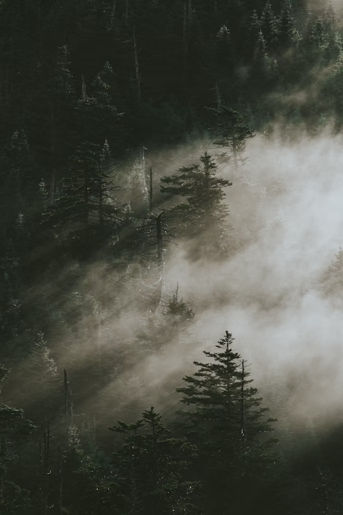
Low cloud over forested Smoky Mountain ridges. Photo: Beatrice Calvo / Unsplash 
Spruce framing cloud-topped ridges from Newfound Gap. Photo: w_lemay / Wikimedia Commons (CC BY-SA 2.0) 
Green ridges rising above a Newfound Gap overlook wall. Photo: w_lemay / Wikimedia Commons (CC BY-SA 2.0) 
A low stone building with a wide porch on a green lawn. Photo: Brian Stansberry / Wikimedia Commons (CC BY 3.0) 
A quiet paved path through tall hardwoods. Photo: Northern-Virginia-Photographer / Wikimedia Commons (CC0) 
Late sun on forested ridges under a clear sky. Photo: Missvain / Wikimedia Commons (CC BY 4.0) 
A white trillium blooming in the forest. Photo: Fredlyfish4 / Wikimedia Commons (CC BY-SA 3.0) 
Map of Great Smoky Mountains National Park. Photo: U.S. NPS / Wikimedia Commons (public domain)
Sources
Photos
A weathered barn in the open meadow of Cades Cove. Photo: Lee Ann Ratledge / Wikimedia Commons (CC BY 4.0)
Low cloud over forested Smoky Mountain ridges. Photo: Beatrice Calvo / Unsplash
Spruce framing cloud-topped ridges from Newfound Gap. Photo: w_lemay / Wikimedia Commons (CC BY-SA 2.0)
Green ridges rising above a Newfound Gap overlook wall. Photo: w_lemay / Wikimedia Commons (CC BY-SA 2.0)
A low stone building with a wide porch on a green lawn. Photo: Brian Stansberry / Wikimedia Commons (CC BY 3.0)
A quiet paved path through tall hardwoods. Photo: Northern-Virginia-Photographer / Wikimedia Commons (CC0)
Late sun on forested ridges under a clear sky. Photo: Missvain / Wikimedia Commons (CC BY 4.0)
A white trillium blooming in the forest. Photo: Fredlyfish4 / Wikimedia Commons (CC BY-SA 3.0)
Map of Great Smoky Mountains National Park. Photo: U.S. NPS / Wikimedia Commons (public domain)
A wooden-railed road bridge over Abrams Creek in Cades Cove. Photo: David Ratledge / Wikimedia Commons (CC BY 4.0)
Clingmans Dome Road curving beneath a rock cut. Photo: w_lemay / Wikimedia Commons (CC BY-SA 2.0)
NPS & Government